
Hurricane Francine made landfall Wednesday in Terrebonne Parish, about 30 miles southwest of Morgan City. As of 10 p.m. Francine has weakened to a Tropical Storm as it batters the Northshore parishes. New Orleans, Jefferson Parish, and the River and Bayou parishes are now dealing with a Flash Flood Emergency. To see flooded roads in New Orleans, click here. Power outages in Louisiana numbered in the thousands, spreading across a wide area of southeast Louisiana. Hardest hit by the blackouts was Terrebonne Parish near where the storm’s center hit land, as well as neighboring St. Mary Parish that includes Morgan City.LANDFALL:Hurricane Francine made landfall as a category 2 hurricane with 1oo mph winds. The minimum central pressure was 972 mb. The storm is moving northeast at 17 mph.The storm is already starting to weaken. Watch the video for the latest update, as of 6 p.m. Wednesday: CURRENT ALERTS:A Tornado Watch has been issued for all of Southeast Louisiana until 11 p.m. As Hurricane Francine moves through Southeast Louisiana, there is the possibility we could see quick forming tornadoes that could cause damage. A Flash Flood Warning has been issued for New Orleans until 9:30 p.m. A Flash Flood Warning has been issued for Houma until 7:15 p.m.A Flash Flood Warning has been issued for Lafourch Parish until 8:00 p.m.A Flood Advisory has been issued for Orleans, Jefferson, Plaquemines, and St. Bernard Parishes until 4:45 p.m. Wednesday. Terrebonne and Lafourche Parishes are under Hurricane Warnings.A Hurricane Watch is now in effect for the New Orleans Metro and areas surrounding Lake Pontchartrain. A Tropical Storm Warning is still in effect for the New Orleans Metro, Plaquemines, St. Bernard, St. Tammany, and Tangipahoa Parishes. LOCAL IMPACTS: WIND:Right now winds have been detected on radar on the order of 70-90 mph with estimated winds on the ground at 65-75 mph with higher gusts. STORM SURGE:Peak storm surge will be highest just west of Port Fourchon where they’re expecting the potential of 5′-10′. For Grand Isle, a peak surge is forecast from 4′-7′. For the rest of the coast farther east and for Coastal Mississippi, a surge of 2′-4′ is forecast but for Lake Pontchartrain and Lake Maurepas a surge of 4′-6′ is now forecast. RAINFALL:Floodingis our greatest concern after a couple of recent heavy rain events in the past two weeks.Radar estimates show totals around 4″-5″ along the coast, 2″-3″ as you move northward through the South Shore, and 1″-2″ over the Northshore.Forecasts are calling for widespread totals of 4-8 inches with locally higher amounts, especially around lower Terrobonne Parish. Be prepared to withstand several days without power. Power outages are ticking up minute by minute. The entire WDSU First Warning Weather Team will continue to provide you with all the latest information on this storm.
Hurricane Francine made landfall Wednesday in Terrebonne Parish, about 30 miles southwest of Morgan City.
As of 10 p.m. Francine has weakened to a Tropical Storm as it batters the Northshore parishes.
New Orleans, Jefferson Parish, and the River and Bayou parishes are now dealing with a Flash Flood Emergency.
To see flooded roads in New Orleans, click here.
Power outages in Louisiana numbered in the thousands, spreading across a wide area of southeast Louisiana.
Hardest hit by the blackouts was Terrebonne Parish near where the storm’s center hit land, as well as neighboring St. Mary Parish that includes Morgan City.
LANDFALL:
Hurricane Francine made landfall as a category 2 hurricane with 1oo mph winds.
The minimum central pressure was 972 mb. The storm is moving northeast at 17 mph.
The storm is already starting to weaken.
Watch the video for the latest update, as of 6 p.m. Wednesday:
CURRENT ALERTS:
A Tornado Watch has been issued for all of Southeast Louisiana until 11 p.m. As Hurricane Francine moves through Southeast Louisiana, there is the possibility we could see quick forming tornadoes that could cause damage.

A Flash Flood Warning has been issued for New Orleans until 9:30 p.m.
A Flash Flood Warning has been issued for Houma until 7:15 p.m.
A Flash Flood Warning has been issued for Lafourch Parish until 8:00 p.m.
A Flood Advisory has been issued for Orleans, Jefferson, Plaquemines, and St. Bernard Parishes until 4:45 p.m. Wednesday.

Terrebonne and Lafourche Parishes are under Hurricane Warnings.
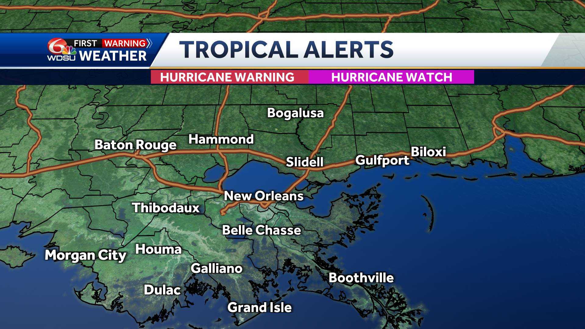
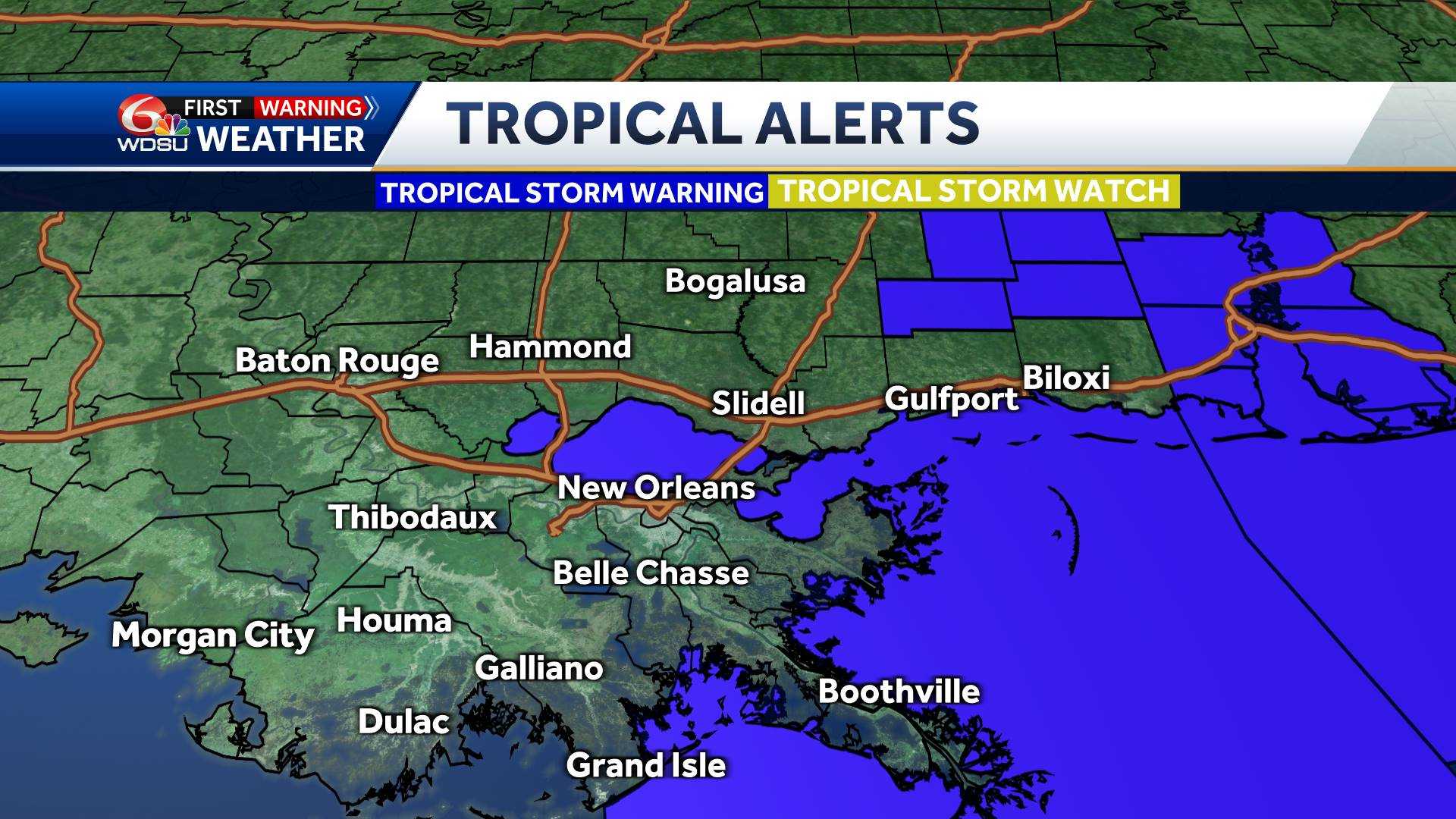
A Hurricane Watch is now in effect for the New Orleans Metro and areas surrounding Lake Pontchartrain. A Tropical Storm Warning is still in effect for the New Orleans Metro, Plaquemines, St. Bernard, St. Tammany, and Tangipahoa Parishes.
LOCAL IMPACTS:
WIND:
Right now winds have been detected on radar on the order of 70-90 mph with estimated winds on the ground at 65-75 mph with higher gusts.
STORM SURGE:
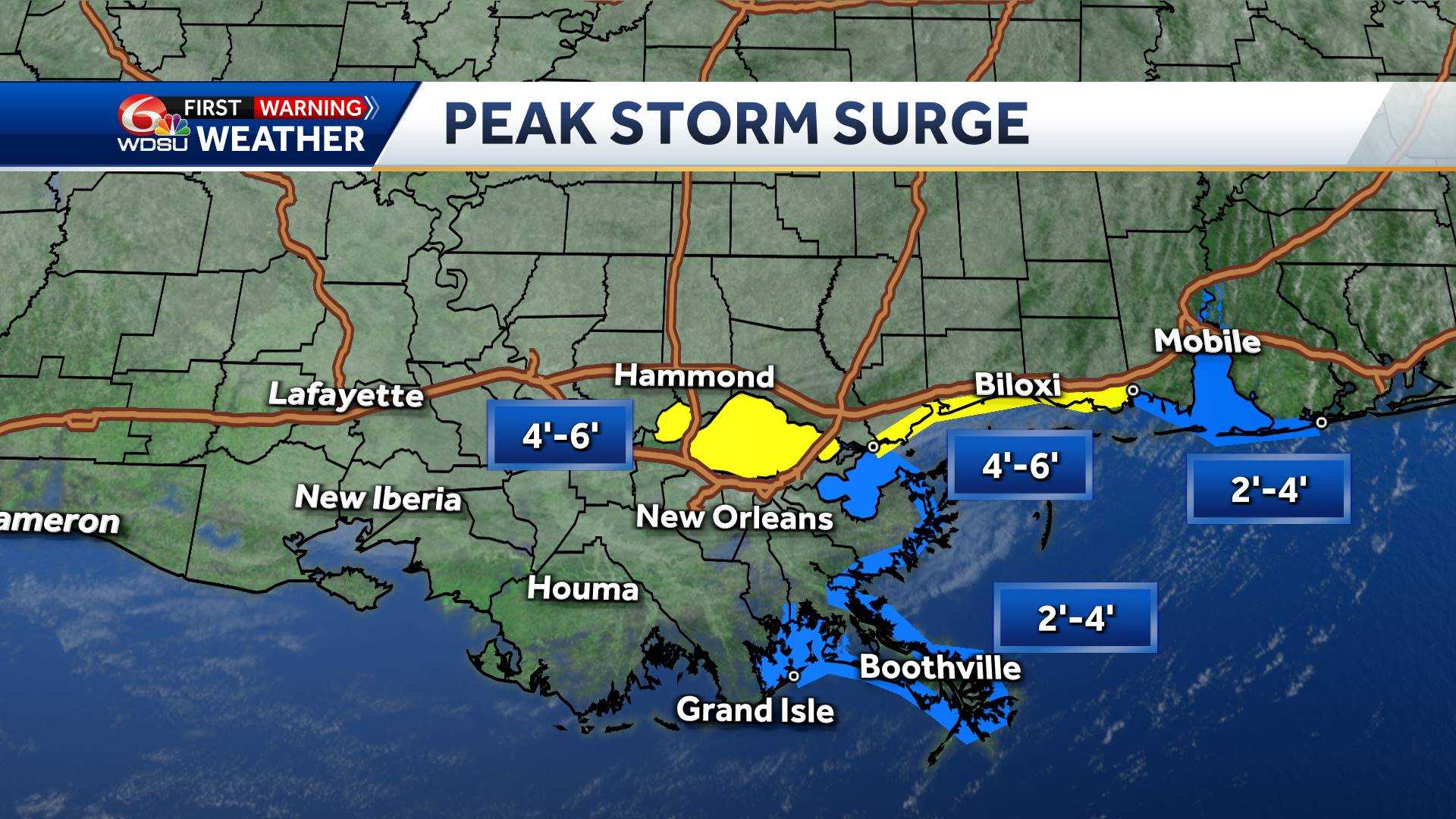
Peak storm surge will be highest just west of Port Fourchon where they’re expecting the potential of 5′-10′. For Grand Isle, a peak surge is forecast from 4′-7′. For the rest of the coast farther east and for Coastal Mississippi, a surge of 2′-4′ is forecast but for Lake Pontchartrain and Lake Maurepas a surge of 4′-6′ is now forecast.
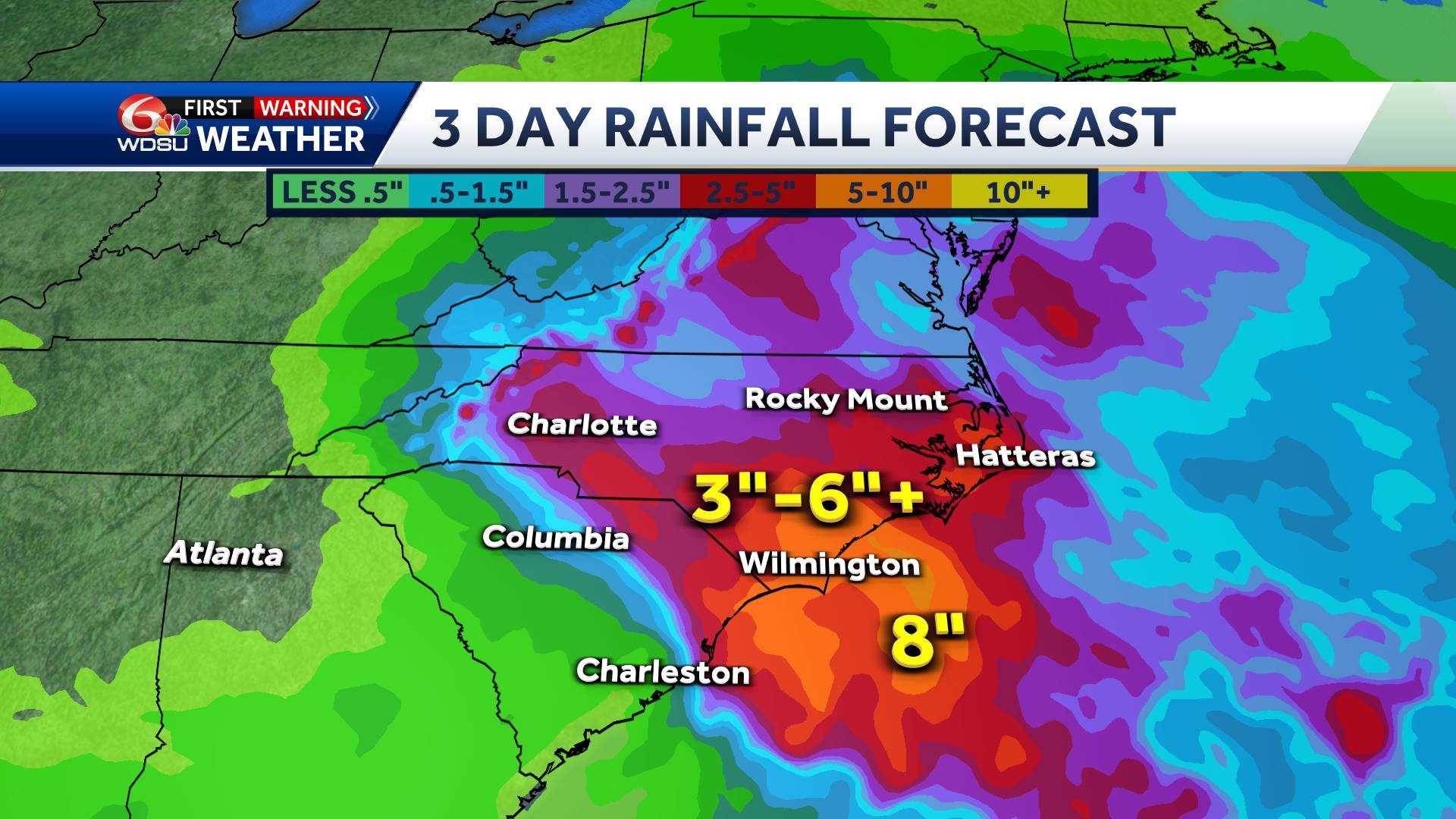
RAINFALL:
Floodingis our greatest concern after a couple of recent heavy rain events in the past two weeks.
Radar estimates show totals around 4″-5″ along the coast, 2″-3″ as you move northward through the South Shore, and 1″-2″ over the Northshore.
Forecasts are calling for widespread totals of 4-8 inches with locally higher amounts, especially around lower Terrobonne Parish.
Be prepared to withstand several days without power. Power outages are ticking up minute by minute.
The entire WDSU First Warning Weather Team will continue to provide you with all the latest information on this storm.
Discover more from PressNewsAgency
Subscribe to get the latest posts sent to your email.