

Tornado Warning issued in Western Pa. | Other warnings in place
Over an inch of rain is possible for these areas.
PITTSBURGH —
Today is a Severe Weather Alert Day for two rounds of active weather around western Pennsylvania. This afternoon will carry a dual threat of flooding and severe storms.
Tornado Warning
A Tornado Warning has been issued for parts of Westmoreland and Indiana counties.
The National Weather Service said the alert will remain in place until 5 p.m.
Locations impacted include… Blairsville, Derry, Ligonier, New Florence, Seward, Bolivar and Loyalhanna Gorge.
WATCH LIVE COVERAGE IN THE PLAYFINDER ABOVE
Severe Thunderstorm Warning
Multiple counties remain under a Severe Thunderstorm Warning Sunday.
The National Weather Service said the warning will remain in place for parts of Allegheny, Westmoreland, Armstrong, Butler, Beaver and Lawrence counties until 4:30 p.m.
Locations impacted include… Pittsburgh, Penn Hills, Mount Lebanon, Bethel Park, Ross Township, McCandless Township, Monroeville, Cranberry, Greensburg, McKeesport, Butler, Franklin Park, Jeannette, Vandergrift, Kittanning, Apollo, Shaler Township, Plum, West Mifflin and North Side Pittsburgh.
Other parts of Westmoreland, Armstrong, Butler, and Indiana counties are also under the alert until 5 p.m.
Locations impacted include… Indiana, Vandergrift, Kittanning, Homer City, Apollo, Murrysville, Blairsville, Ford City, Derry, Delmont, Leechburg, Freeport, Black Lick, West Kittanning, Clymer, North Apollo, West Leechburg, Avonmore and Orchard Hills.
Severe Thunderstorm Watch
A Severe Thunderstorm Watch has been issued for parts of Western Pennsylvania Sunday.
The National Weather Service has issued the watch for Allegheny, Armstrong, Beaver, Butler, Clarion, Fayette, Greene, Indiana, Lawrence, Mercer, Venango, Washington, and Westmoreland counties.
The watch will remain in effect until 8 p.m.
Flash Flood Warning
A Flash Flood Warning has been issued for parts of Washington County.
The warning is expected to remain in place until 7:15 p.m.
Some locations that will experience flash flooding include… McMurray, Washington, Canonsburg, Avella, Gastonville, Cecil-Bishop, Wolfdale, McGovern, East Washington, McDonald, Houston, Eighty Four, Hickory, Finleyville, West Middletown, Meadow Lands, Midway and Atlasburg.
Flood Watch
The Flood Watch is for Allegheny, Beaver, Fayette, Greene, Washington, and Westmoreland counties along with Monongalia and Preston in West Virginia and Garrett in Maryland. The watch will run through 8 a.m. Monday. Rainfall rates up to two inches per hour are possible, which is enough to flood anywhere that sees that much rain that quickly.
These same areas have been time and time again from very heavy rainfall.
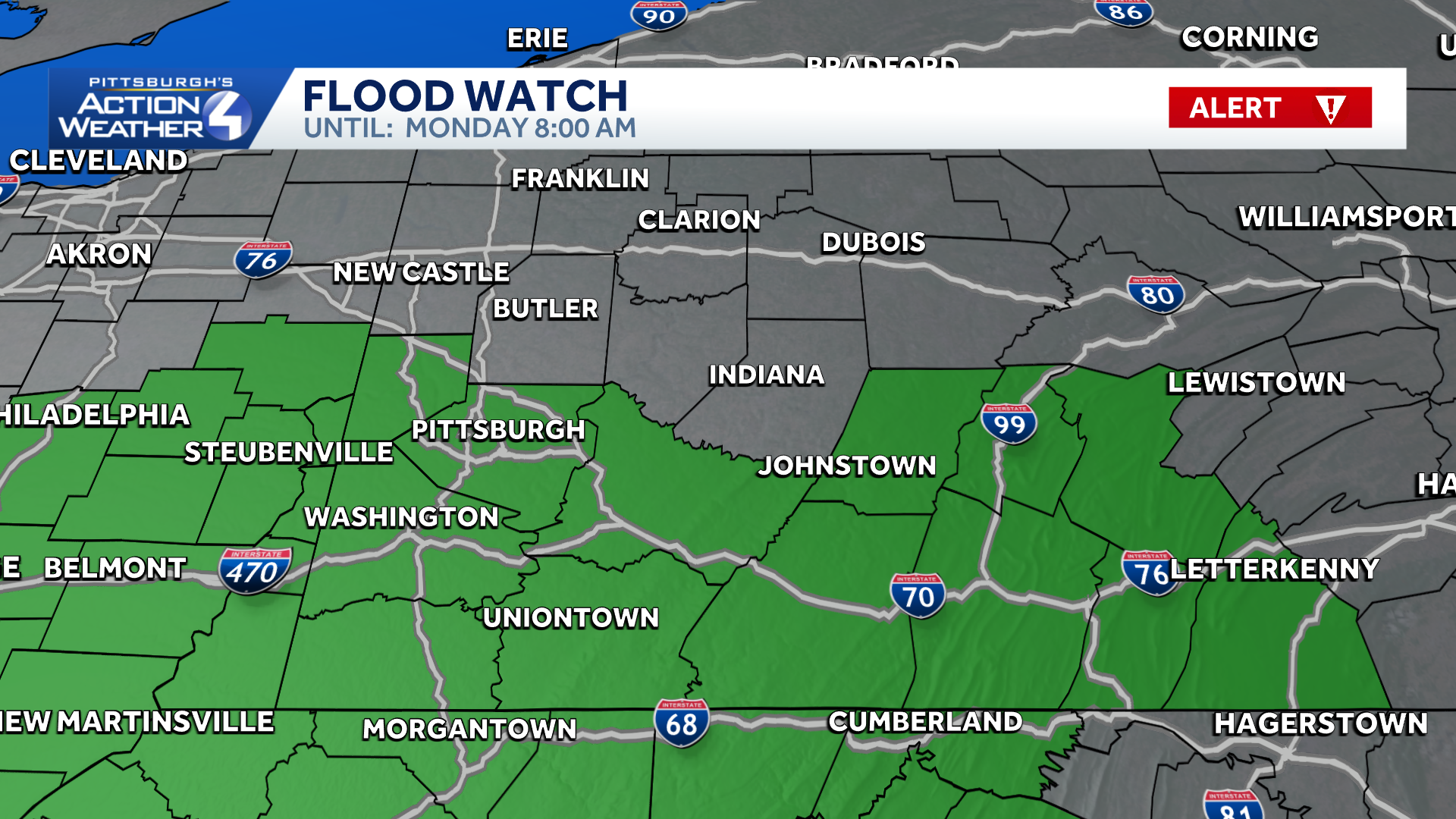
Alert Day: Flooding and severe weather risk
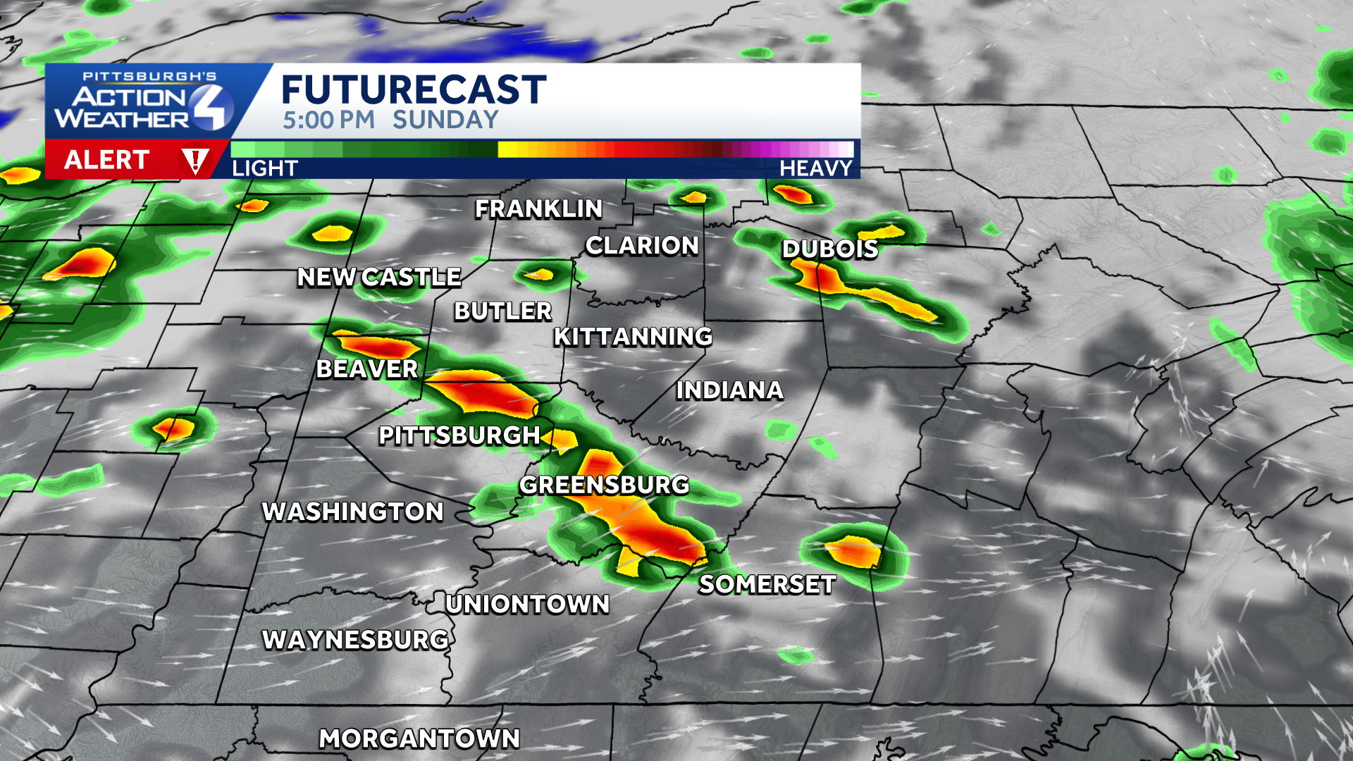
Scattered strong to severe thunderstorms develop after 2 p.m.
We will then see a lull in the rain through midday before a broken line of storms likely develops and moves into our area after 2 p.m. This round will feature a severe weather threat with damaging wind the primary concern. Flooding will also be possible in locations that are hit again by downpours. A brief tornado also cannot be ruled out. The severe threat will end by 9 p.m. at the latest.
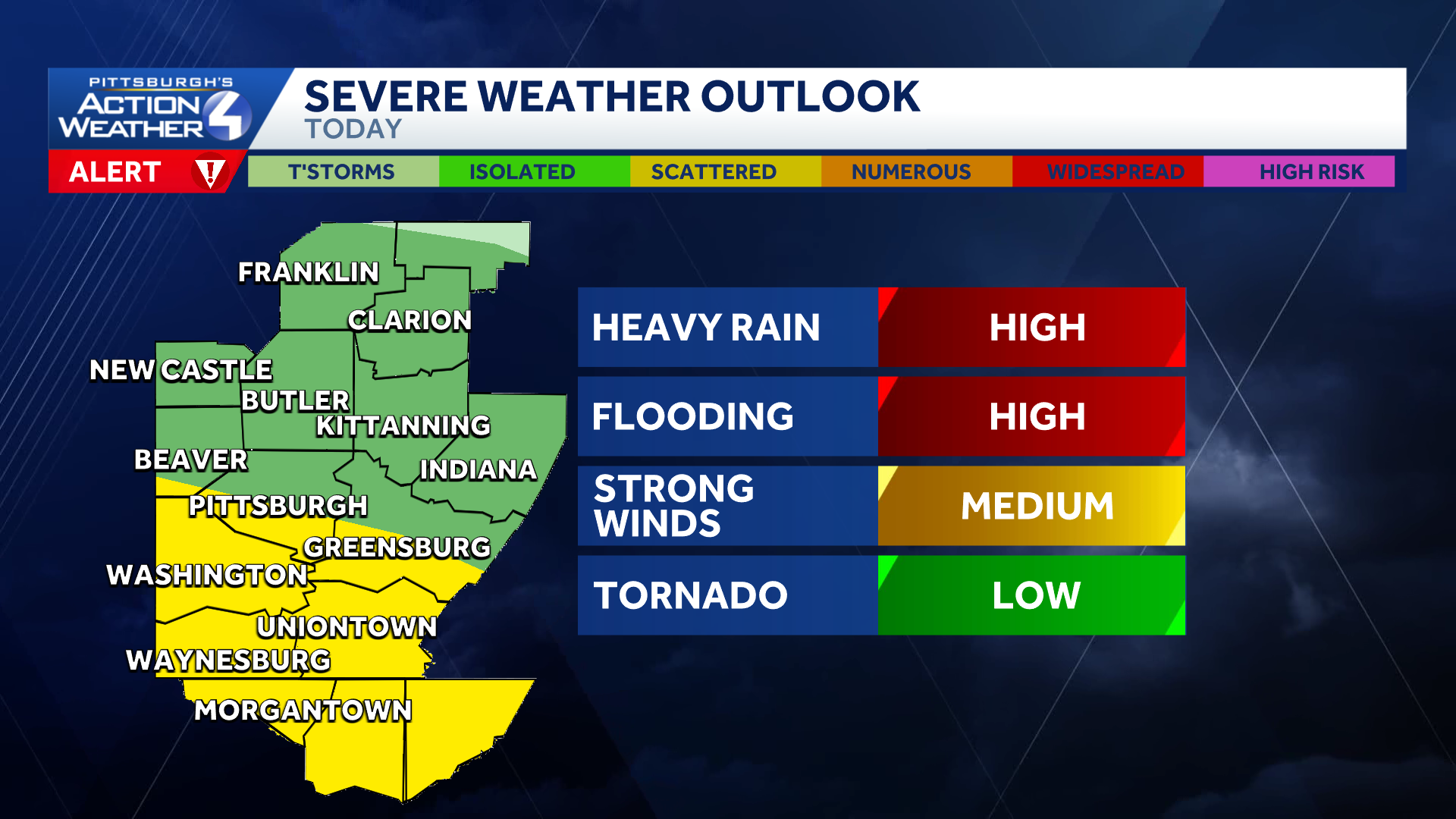
Flooding lead the storm threats, along with damaging winds and a low-end, brief tornado.
Discover more from PressNewsAgency
Subscribe to get the latest posts sent to your email.